 Home
HomeLandcover and Landscape Properties Associated with Hantavirus Occurrence in Paraguay
Dr. Nicolaysen and her students are studying active volcanism in the Aleutian island arc and flood basalt lavas of the Kerguelen Archipelago. Comprehensive geologic and hazards maps have never been compiled for Yunaska or Chuginadak Islands (Aleutians).Satellite imagery is crucial to compiling these maps and to determining relative ages of lava flows. For example older lava flows are more vegetated and/or have lower amounts of radar backscatter compared with young, jagged flows. M.Sc. students Michael E. Brown and David L. Bridges have used Landsat, ERS and Space Shuttle imagery for their graduate projects investigating Aleutian volcanism.
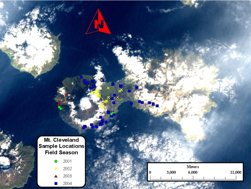
Figure caption: Geology graduate student David Bridges compiled locations of lavas sampled for geochemical investigation on this Landsat image.